Intro
Did you know the word geometry means “Measuring the earth ?” Since the beginning of the known human era we have attempted to find where we are in relation to the world and even the universe around us. Where can we find each other and how do we get from where we are to that delicious new berry patch, hunting ground, or Italian restaurant with the free breadsticks?

Early Examples of Mapping
Passing pre-historic maps of the stars for an adventure another day, we see that some of our oldest known artifacts often include geography and mapping of the world around us. One of the earliest maps of the known world comes from Babylonia. It displays islands, rivers, cities, and even some objects of what seems to be mythical origins. This ancient tablet appears very different than the maps we have now. What are some difference you notice?
Another ancient example of a map comes from the Bible. Chapter two of the book of Genesis begins with a relative location of the Garden of Eden,
“A river watering the garden flowed from Eden; from there it was separated into four headwaters. The name of the first is the Pishon; it winds through the entire land of Havilah, where there is gold. (The gold of that land is good; aromatic resin and onyx are also there.) The name of the second river is the Gihon; it winds through the entire land of Cush. The name of the third river is the Tigris; it runs along the east side of Ashur. And the fourth river is the Euphrates. ”
We might expect early texts to be only a general reference map of an area, but this one not only describes where the garden is, but also includes important highlights about the area around the garden which morphs this example into more of a thematic map including resources in the area.
Travelling through time we find ourselves meeting with our third and final examples of ancient mapping; those experts in exploring both the earth and celestial entities, the Greeks. Take a moment to close your eyes and imagine what the world as a whole looks like. You will likely see land masses of the continents, oceans all around and a circular shape drifting through space. Much of this modern view of the world can be attributed to the early scientists and deep thinkers such as Aristotle and Ptolemy. Aristotle is attributed as the first to prove that the earth is round in shape. He did this by using three proofs:
“(I) that the earth must be spherical, because of the tendency of matter to fall together towards a common centre; (2) that only a sphere could always throw a circular shadow on the moon during an eclipse; and (3) that the shifting of the horizon and the appearance of new constellations, or the disappearance of familiar stars, as one travelled from north to south, could only be explained on the hypothesis that the earth was a sphere .”
One of the first scientist to work out a common method for cartography and place definite positions of imaginary lines creating a grid over the world is Ptolemy. These latitude and longitude lines (although altered for more precise accuracy later) are still used today to locate absolute location anywhere in the known world !
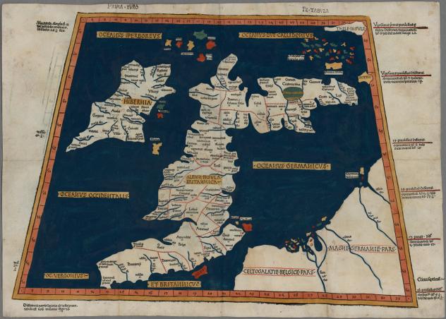
Do you recognize where the area depicted on this map is from this reproduction of one of Ptolemy’s maps?
Christopher Columbus would later use much of the knowledge collected from both Ptolemy and Aristotle in his explorations of the world. He risked his own life and many others in the confidence that this knowledge was correct. What a surprise he must have had when knowledge passed down through hundreds of years was proven and disproven by new discoveries!
SOURCES:
https://www.quora.com/How-were-maps-made-before-satellites-1
Genesis 2:10-14 NIV
http://www.theodora.com/encyclopedia/g/geography.html
https://archive.org/stream/isisacad05acaduoft#page/74/mode/2up