Cartography tools have improved vastly through the ages. But the mathematical ideas and equations have remained the same in all periods.
One of the original “tools of the trade” for cartographers included a sextant. At noon the sun is in its highest position in the sky. At this time, a cartographer can look through the telescope of their sextant and line up the sun superimposed with the horizon. If no horizon can be seen (because of mountains, trees, or other obstructions), an artificial horizon can be used to find the correct position of the horizon . The angle of where the sun is in relation to the horizon compared to information collected from the past on that same date from other locations, will allow the latitude of that position to be obtained.

Astronomical navigation.
Sextants are used by lining up the sun to the horizon at noon to assist in finding latitude.
Longitude can be calculated by using the stars. A scientist or cartographer might observe star paths in the sky in relation to the moon, other stars, and the horizon and time each of these movements in order to read longitude in a given position .
For topographical mapping, cartographers use the laws of plane trigonometry which tells us that the length of just one side and 2 angles of a triangle is all we need to know in order to determine the length of the remaining 2 sides and final angle. This triangulation method is one of the basic formulas that surveyors and cartographers use when creating maps and can be determined using dead reckoning for length and a theodolite which is used to measure the two angles at the ends of the given length. This tool is still used today, but is typically a combination instrument called a phototheodolite which combines the modern mapping technique of photogrammetry with that of the ancient theodolite for more precise terrestrial measurements . Dead reckoning has been vastly improved through the years, and uses the science of physics to determine distance. The basic formula for this measurement is Distance Traveled = Speed x Time .

Use of modern mapping and surveying methods is practiced at most construction sites to ensure accuracy.
What’s so wonderful about scientific and mathematical formulas is that even as technology changes, these formulas remain constant. Current tools of mapping include the use of the global positioning system which uses 24 Earth orbiting satellites and still tracks speed, direction and time to use in the same formula to determine location. For example, in areas that are extremely difficult or impossible to reach by land, aerial photogrammetry can be used in addition to tracking the aircrafts location making maps even more detailed than ever before.
Triangulation is made easier by tools such as geodimeters and 3-D laser scanners. A 3-D laser scanner can send a pulse of light out and tracks how long it takes that light to be reflected back in order to determine distance. Dead reckoning has been improved to include Doppler Effect readings, electronic and optical sensing systems and many more computed formulas and measurements in order to achieve very accurate readings on positions in latitude and longitude . These tools and many others have greatly reduced the time it takes to determine accurate position for mapping .
The newest addition to the ancient art of mapmaking is striving towards up to the minute data. Google is one of the biggest data-drivers in this market and combines every tool at their disposal to create such a map for the Google Maps app, Google Earth, and Street View. Driving more than 5 million miles with custom car-mounted cameras, incorporating Census information, satellite imagery, indexes of road signs, business signs, traffic data, and much more has allowed us to build a system of tracking and data gathering unlike anything we’ve seen before !
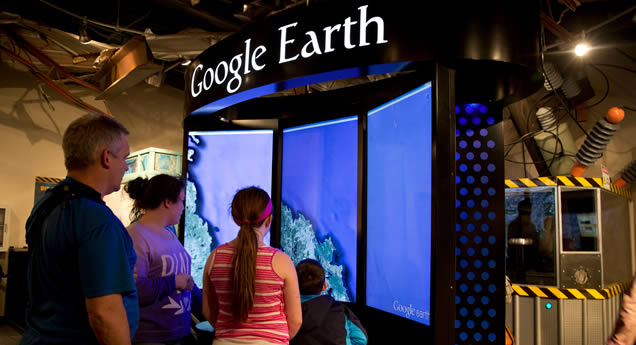
Check out the most optimized mapmaking stretched across 3 huge screens at WonderWorks by interacting with our Google Earth exhibit!
Just imagine how much easier it would have been for our ancestors’ quest for food to simply say, “Navigate to a deer near me.”
Sources:
http://www.history.army.mil/lc/the%20mission/lc_pamphlet/index.htm)
http://www.britannica.com/technology/theodolite)
http://electron6.phys.utk.edu/101/CH1/speed_and_velocity.htm)
http://www.britannica.com/technology/dead-reckoning-navigation)
http://ctsurveyors.org/wp-content/uploads/2014/02/February-2014-Newsletter.pdf p.11)